Tollesbury Wick Marshes
Map and guide
Gallery

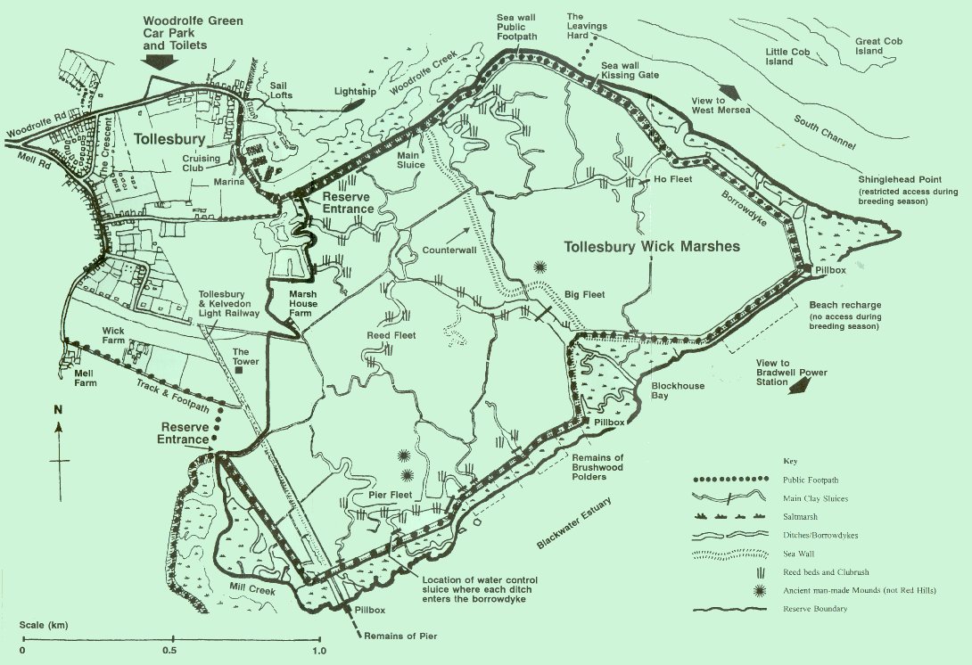
Tollesbury Wick Marshes - Map
Tollesbury Wick Marshes
TOLLESBURY WICK MARSHES
Visitor guide to the reserve
Welcome to TOLLESBURY WICK MARSHES
We hope you enjoy your visit
The reserve, 600 acres of coastal grazing marsh, sea walls and saltings, shows how traditional coastal farming with grazing livestock can encourage a superb variety of wildlife. The whole area lies within the Department for Environment, Food and Rural Affairs (DEFRA) major agri-environmental scheme, the Essex Coast Environmentally Sensitive Area (ESA). Its conservation importance has attracted both national and international designation
The reserve is a Site of Special Scientific Interest (SSSI), and forms part of the Mid-Essex Coast Special Protection Area (SPA) for wild birds and a Wetland of International Importance/Ramsar Site, in particular because of its overwintering birds. Its estuarine and unusual marine communities on the fringes of the reserve form part of the Blackwater Estuary National Nature Reserve (NNR), as well as part of the Essex Estuaries Special Area of Conservation (SAC).
It became an Essex Wildlife Trust reserve in 1993. From the car park at Woodrolfe Green follow the road for 350 metres and turn right just before the Sail Lofts, up the concrete steps to pick up the public footpath on the sea wall. Continue past the Marine Pool, the Tollesbury Marina and Clubhouse to the gate at the reserve entrance. The sea wall stretches out along Woodrolfe Creek and sweeps around the horizon enclosing the main body of the marsh. From the wall you win be able to appreciate the Essex coast, the history which formed it and the wildlife it supports. Beyond are the town of West Mersea, Bradwell Power Station and on rising land
behind Marsh House Farm buildings, a Second World War observation tower.
The public footpath follows round the sea wall giving a 8 km walk from the Marina back through the village to the car park, and takes about 3 to 4 hours. The route is exposed to the elements so be prepared.
If you have a dog then it must be kept under strict control because of the risk to grazing livestock and the disturbance to wildlife.
Background
The grazing marshes at Tollesbury Wick were reclaimed from the sea by the construction of the sea wall. To the inside of the sea wall is the borrowdyke (a long ditch dug out to provide material for the sea wall), and to the outside is a narrow fringe of saltmarsh and expanse of mud and shingle.
The origins of the sea wall go back probably to the late Middle Ages. It was clearly marked on the Chapman and Andre map of 1777, and firmly consolidated by the 1860s. This was followed by the construction of the Tollesbury and Kelvedon Light Railway, which eventually opened in 1904. Remains of the terminus at Tollesbury Pier are still visible in the south west comer of the reserve. Its proposed development as a yachting centre did not occur and the branch line closed to passengers in 1951.
Two years later the !953 floods prompted further raising and strengthening of the sea walls. Other features of historical interest include ancient man-made mounds and Second World War constructions. In spite of all these developments that have come and gone, traditional grazing with sheep and cattle continued, until, that is, the pressure for arable land saw 146 acres drained and ploughed. Fortunately, most of the marshes survived and now Essex Wildlife Trust has reinstated them as an example of one of the best grazing marshes in Essex, aiming to combine good farming with good conservation. Since 2000, the Trust has built up a flock of Shetland and North Ronaldsay Sheep. It now also owns a suckler herd of Shetland cattle, an endangered traditional breed that, like the sheep breeds, is ideally suited to the rough grazing on the marshes.
Along the sea wall to the Leavings
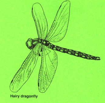
There is some fringing reed and scrub developing along the borrowdyke just inside the reserve which is always worth a look and a listen in summer for Reed Warblers and Reed Buntings as well as dragonflies. Two hundred metres further on is the only outflow sluice for the whole marsh, where precious water can gush out at low tide after heavy rain. Just ahead is a new Counterwall, a high grassy bank that winds its way across to Blockhouse Bay.
Long term, the whole reserve is vulnerable to rising sea levels and more frequent storm events as a result of climate change. By containing any seawater that may overtop the existing seawall to the eastern
end of the reserve, the Counterwall will help to protect the rest of the reserve from permanent damage. Please note there is no public access along the Counterwall.
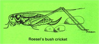
The folding, the flat strip of land between the borrowdyke and sea wall, is good in Summer for plants like Grass Vetchling and Spiny Restharrow, and for grasshoppers and crickets, notably Roesel's Bush
Cricket with its persistent free-wheeling song.
Regain the public footpath on the sea wall to keep a watch on the saltmarsh, which is purple with Sea Lavender in summer, and the muddy creeks which hold a good range of birds.
The Leavings Hard
Across the creek is Great Cob Island and the RSPB reserve of Old Hall Marshes beyond. The creek is likely to have more boats than birds in summer. At other times it is a vast larder for waders like
Redshank, Grey Plover, Curlew and Dunlin, and wildfowl like Shelduck, Brent Geese and Goldeneye.
Looking landward, across the borrowdyke, the first marshes are rather uniform - the 146 acres which were levelled, drained and grew arable crops for 15 years before being put back to set aside and then
returned to marsh.
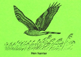
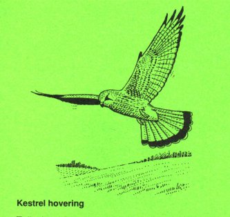
Skylarks will be overhead in the nesting season to test the spots in your eyes, but will be nesting on the ground with Lapwing, Red-shank and Meadow Pipits. The populations of voles which build up here
attract overwintering predators like Hen and Marsh Harriers and Short-eared Owls, alongside the resident Barn Owls and Kestrels. These nearby fields are taken for hay in rotation and then grazed to
provide a short grass sward for the large wintering flocks of Brent Geese and Wigeon.
Dogs must be kept on a lead or under close control from the kissing gate onwards, because of grazing livestock and to prevent disturbance to wildlife.
Shinglehead Point
The Second World War pillbox is a good vantage point to scan the Blackwater Estuary for overwintering duck, geese and divers. You may be lucky to spot Eider, Long-tailed Duck, Great Northern Diver or a Common Seal.
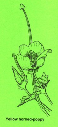
From late April to the end of July please do not venture onto the shingle itself because Little Terns, Oystercatchers and Ringed Plovers will be nesting. The shingle and shells here and further on also
support the Yellow Horned-poppy.
To landward you now look back over traditional grazing marsh which has never been ploughed. The fleets which snake across it are the original saltmarsh creeks prior to reclamation. Many of the small lumps and bumps are long established ant hills of the Yellow Meadow Ant so typical of grazing marshes. If you are lucky you may spot a Brown Hare or a Fox going about their business.
Big Fleet and Blockhouse Bay
Here the sea wall points into the centre of the marsh where Big Fleet meets the borrowdyke. This fleet forms a freshwater reservoir and a habitat for dragonflies and nesting marshland birds. A few hundred metres onto the marsh is a prominent man-made mound of ancient origin. Formerly believed to be a 'RedHill' (where salt was concentrated in Roman times), it may instead have been made to
provide a safe refuge for sheep grazing the saltmarsh if caught out by a high tide.
To seaward is an area of saltmarsh wider than the thin eroded strip which remains in front of most of the sea wall. Loss of saltmarsh is a serious problem because of the risk of the sea wall being undermined. For this reason thousands of tonnes of shingle have been sprayed onto the foreshore from maintenance dredging work in Harwich Harbour. This is called 'Beach Recharge' and is an experimental sea defence technique being undertaken by the Environment Agency to help prevent further saltrnarsh erosion.
The resultant 'island' of shingle has recently attracted many shore nesting birds, including the specially protected Little Terns.
Again, as at Shinglehead Point, please do not land by boat or cross the mud during their breeding season - late April to the end of July.
Tollesbury Pier and Mill Creek
The remains of the pier mark the failed aspirations of Victorian entrepreneurs to develop a port and yachting centre similar to Burnham. The pier deck was removed in 1940 to prevent an enemy landing.
The terminus station for this, the Crab and Winkle Line, was just inside the sea wall, and the level shows just how much the sea wall has had to be raised since the 1953 floods.
To the east of the railway embankment is an area of grazing marsh where the Trust has created some wet marsh areas by installing sluices and directing water into the reedbed at Pier Fleet. This was the
first wet area of a scheme under the Essex Coast ESA, designed to bring grazing marshes back along the Essex coast.
Shrubby Seablight, the largest of saltrnarsh plants is well established here at Mill Creek growing along the strand line at the base of the sea wall. At the head of the Creek turn right to take the footpath
which brings you to the track and public footpath through Mell Farm and thence onto Mell Road back to Tollesbury Village.
The Crescent' provides a short cut back to your car, but spend a little time in Tollesbury if you can - it's a fine self-sufficient village with a long history of sailing, wildfowling, smuggling, oysters, railways
and everything else which goes with Essex coast life. And there are two good pubs for lunch if you time it right.
Join us Today!
The support of over 27,000 members enables the Trust to look after Tollesbury Wick Marshes as well as 87 other nature reserves throughout Essex.
Call us for a free guide. Telephone 01621 862960 Website www.essexwt.org.uk
Please support the Trust by becoming a member.
Membership subscriptions Single £21.00, Joint £27.00.
We will send your Membership Card, current magazines, Essex Wildlife and Natural World and details of our Visitor Centres and Nature Reserves.
The Joan Elliot Visitor Centre
at Abbotts Hall Farm,
Great Wigborough,
Colchester,
Essex CO5 TRZ
Tel. 01621 862960, E-mail [email protected], Website www.essex:wt.org.uk
Registered Charity No.210065
From a leaflet scanned and reformatted May 2008
